
價格:免費
更新日期:2019-05-21
檔案大小:29.1 MB
目前版本:0.9.5
版本需求:需要 iOS 11.0 或以上版本。與 iPhone、iPad 及 iPod touch 相容。
支援語言:英語
Mapillary for Drivers is an app for contributing to Mapillary Capture Projects—a tool that helps quickly cover an area with fresh street-level imagery by dividing it into tasks that are assigned to drivers. Drivers complete their tasks by capturing imagery and recording progress with the Mapillary for Drivers app. You can only use the app if you’re part of a capture project.
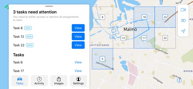
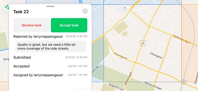
1. Accept tasks assigned to you by the project admin
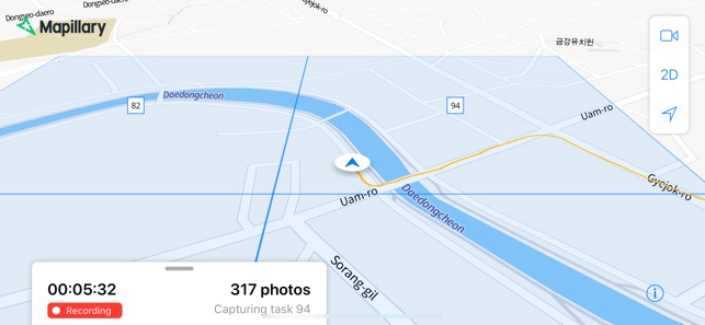
2. Log your capture sessions with the app

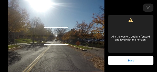
3. Use the smartphone to capture and upload imagery
4. Submit completed tasks for admin review and get feedback
5. Get an overview of your driving activity and stats
Capture Projects can be set up and managed on the Mapillary web app. Drivers only need to use the mobile app—progress is recorded automatically and visible to project admins in real time on the web dashboard.
All uploaded imagery is processed with computer vision on the Mapillary platform to detect objects in images and generate fresh map data that’s available to everyone for updating maps. To access imagery and map data, go to https://www.mapillary.com/app.
ABOUT MAPILLARY
Mapillary is the street-level imagery platform that scales and automates mapping using collaboration, cameras, and computer vision. Anyone can capture images of any place, as often as needed. Mapillary connects all images to create 3D views of places and automatically extract map data from the imagery, making it available to anyone to make better maps and develop our cities and traffic environments.
支援平台:iPhone, iPad